Under the Pavement, a River: Following Leicester's Vanished Waterways
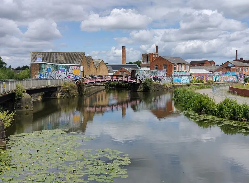
Photo: Mat Fascione , CC BY-SA 2.0, via Wikimedia Commons
Leicester is a city you can read through water. The Soar is still here, the Grand Union Canal is still here, and on a wet November afternoon both make themselves known. But there is another map underneath the pavement: a tangle of brooks, ditches and old river channels that once shaped where people built, traded and walked. Most of them are gone from daily view. Some are culverted. Some are remembered only in a street name or a bend in the road. This loop is a two-hour walk through that hidden geography.
Before you set off
Start at Jubilee Square and finish at Waterside. The route is around two miles and mostly flat, but it is an urban walk rather than a countryside ramble. You will cross busy roads, pass construction sites and spend time on pavements. Wear shoes you can stand in for a couple of hours, bring a waterproof and keep a map on your phone. Treat this as a historical trail, not an archaeological survey. The aim is to notice the clues, not to lift a manhole cover and expect a river to wave back.
The town ditch and the market
Begin at Jubilee Square, where the modern city is at its most polished. Local histories of Leicester often mention the town ditch and the old watercourses that fed the medieval settlement. The details are complicated, and historians do not always agree on every channel, but the principle is simple: water came first, and the streets followed. Walk towards Millstone Lane, a name that does exactly what it says on the sign. Mills need water. Even when the water is no longer visible, the name keeps the connection alive.
Continue towards Horsefair Street and the Market Place. Leicester Market has been a trading heart for centuries, and markets need drains, wells and somewhere for the rain to go. Look at the slope of the streets rather than the shopfronts. The city still drains towards the river, even if the old brooks have been tucked into pipes beneath your feet.
Blackfriars and the buried brook
Head towards Blackfriars, where the street names and old buildings give you a sense of the medieval city. This is a good place to slow down. The area around Blackfriars once sat close to water channels and marshy ground, and the Dominicans who gave the area its name knew exactly why that mattered. A brook in a city is never just scenery. It is a drain, a power source, a boundary and a nuisance, often all at once.
You will not find a grand monument to the Blackfriars Brook. That is the point. Look instead for the small giveaways: a street that dips unexpectedly, a wall that follows an old edge, a name that sounds more rural than the traffic around it. The lost rivers of Leicester are not hidden because someone deliberately erased them. They disappeared because cities are good at covering things up when they need the space.
Frog Island and the old river channels
Make your way north towards Frog Island and Soar Lane. This is one of the most evocative parts of the loop. The name Frog Island suggests wet ground, and the area's history is closely tied to the river and the industries that grew beside it. The Soar was once wider, slower and more prone to flooding, and the channels around it shifted over time. What you see today is a managed river, kept in its place by walls, roads and flood defences.
Stand near the water and look back towards the city. The old channels are not visible, but the shape of the streets still hints at them. Soar Lane, Bath Lane and Waterside all carry water in their names. That is the trick of this walk: you are not following a river so much as following the language it left behind.
Abbey Park and the canal
From Frog Island, continue towards Abbey Park and the Grand Union Canal. This is the most obvious water of the walk, and after all that ghost-hunting it is a relief to see some. The canal is not a lost river, but it belongs to the same story of Leicester using water to move goods, people and money. Walk along the towpath for a stretch if the light is good and the path is not too busy.
Abbey Park itself is a reminder that water management is never finished. Rivers are redirected, banks are built, floods are remembered and then partly forgotten. The city's wider lost waterways, from the Evington Brook to the Humberstone Brook and the Saffron Brook, tell the same story in different neighbourhoods. Some still flow in daylight. Others are piped and paved over. All of them shaped the streets above them.
The loop back
Follow the canal back towards Waterside and finish near the city centre. By now you should have a different picture of Leicester in your head: not just a city beside a river, but a city built on top of several. The walk is not dramatic. There are no waterfalls, no ruined bridges and no costumed guides. There are street names, odd bends, old walls and the quiet sense that the ground beneath you is more crowded than it looks.
A note on the history
Treat the details as a starting point rather than the final word. Local historians continue to argue about the exact courses of some channels, and much of the evidence is buried, built over or recorded in old maps. That uncertainty is part of the pleasure. Take a photo of a street sign, look up an old map when you get home, and notice how often Leicester's streets still point towards water that is no longer there.